I selected the 2 locations on the Thompson River for observation. The stretch along the river in both locations has large sandy beaches spanning several kilometres. The topography of the surrounding area is characterized by a blend of flat river bottoms transitioning into rolling hills, with residential development, industry and agriculture on the ascending slopes.
The vegetation near the water’s edge is sparse with mostly sand, indicative of a riparian zone, with sporadic grassland and small shrubs past the beach. Further from the water, the density of trees and shrubs increases, hinting at a more forested ecosystem transitioning into urban greenery marked by ornamental trees and residential landscaping.
My visit to the site was on January 3rd 2024, a cool, overcast day between the hours of 3:00pm -5:00pm
Location one: 50˚40’56.1″N120˚20’31.1″W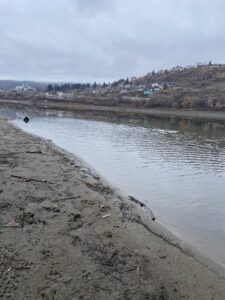
Location two: 50˚41’40.4″N120˚24’02.7″W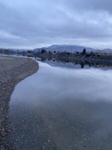
3 Research Questions
-How does algae, as observed under a microscope, differ between the two locations on the Thompson River and do they change with changing temperatures throughout the winter?
-What types of particulate matter can be found in the water at the two sites and what does this indicate about the sources of particles in the river?
-How do the sediment layers along the riverbanks and river bottom differ at the two sites and how does this change over time?