I collected my initial data on 8 Feb 2024 between 17:15 and 17:45. The temperature was around 5 or 6°C and it was cloudy and damp.
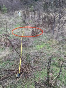
I kept my field kit simple: 1 measuring tape, transect boundaries (4 sticks), 1 waterproof notebook and 1 pencil. My idea had been to use the sticks to make a transect. Each stick was 4’ long. When I got to my site I realized a 16ft2 would not work as it would be far too small (only bounding approximately 1 plant unit). Instead I improvised and instead chose a centre point and then measured 10’ outwards at ~90° angles (to create a cross-shape). I placed a stick perpendicular to the end of the measuring tape in each direction. This then became an ~400ft2 transect. It was a rough estimation as the sticks only gave a visual guide for part of each side of the transect.
I haphazardly chose my first sample location based on that area of the site having an abundance of plants (opportunistically). The next four locations were more haphazard as I just threw one of the sticks twice in the same direction and sampled where it landed the second time (it became my midpoint for the next transect). There was still some selectivity to the locations though as I chose the direction I was throwing the stick.
There was also some uncertainty with counting the plants as it wasn’t always clear whether I was looking at different plant units or one plant with an underground root system that created new shoots away from the main plant. Also I changed my study design from my last blog post. I had intended to use the presence of a large mature plant unit in each transect as my predictor variable for seed dispersion and the presence of the same species plants in nearby vicinity, and I was going to measure the tallest plant. On commencement of sampling I realized that this was flawed. Due to the problems in my last blog post of how to identify plants that had died back for winter, it became evident that the only plants I could identify were the large mature individuals that stood out, and still had some (dead) foliage to be seen. The smaller establishing plants likely made up a lot of the small brown stalks surrounding that I was not counting (i.e., I was only including large mature individuals in my species counts). Also, I realized trying to record the measurement of the tallest plant in an ~400ft2 transect (and which was the largest stem on the largest plant…) was a somewhat pointless endeavour.
On counting the number of species #1 and species #2 in each transect, it seemed to fit with my hypothesis of seed dispersion meaning that both species were concentrated in clumps of either species #1 or species #2. Seeds from a mature plant were landing close-by and creating new plants of the same species. I favour this hypothesis over each species preferring a particular habitat type because the two species are growing in very similar conditions and very near each other. Perhaps more samples may lead to a different hypothesis regarding distribution. I intend to use the same method for the actual sampling, although I will need to restart the sampling effort, as I cannot be certain where I have already counted on initial sampling and I may double count the same plants. I will use the same size transect but split it into quarters using string on the ground so that I can count the number of plant units in each quarter (i.e. four quarters of 100ft2).
Hello Terry
okay yes throwing a stick (or a hoop) can be done to select a plot location
You are correct that facing one direction does make it haphazard somewhat – also, I think unconsciously we might throw to more favourable locations – this could be mentioned in DISCUSSION as a potential bias
quarters seems reasonable approach.